“There is a bench and a fireplace when you reach the Alta-Canyon” says my hiking description. I am standing at this bench and the fireplace but I can’t see anything of the Alta-Canyon. Did I go the long way for nothing without being able to get a glimpse of that natural wonder?
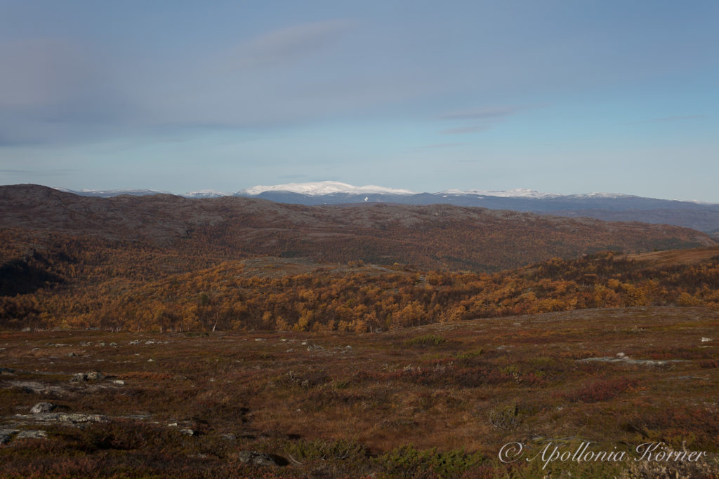
Two hours earlier, me and Taiga – my Alaskan Husky – started at a parking place that is approximately 1.5 kilometers away from the Gargia Fjellstue. The hiking trail to the Alta-Canyon which is also called Sautso-Canyon starts at the parking place and goes to the east. The trail is going over the Finnmarksvidda, a high plateau that covers vast parts of the Finnmark in northern Norway. Far away on the horizon I can see some mountains that are covered with the first snow.
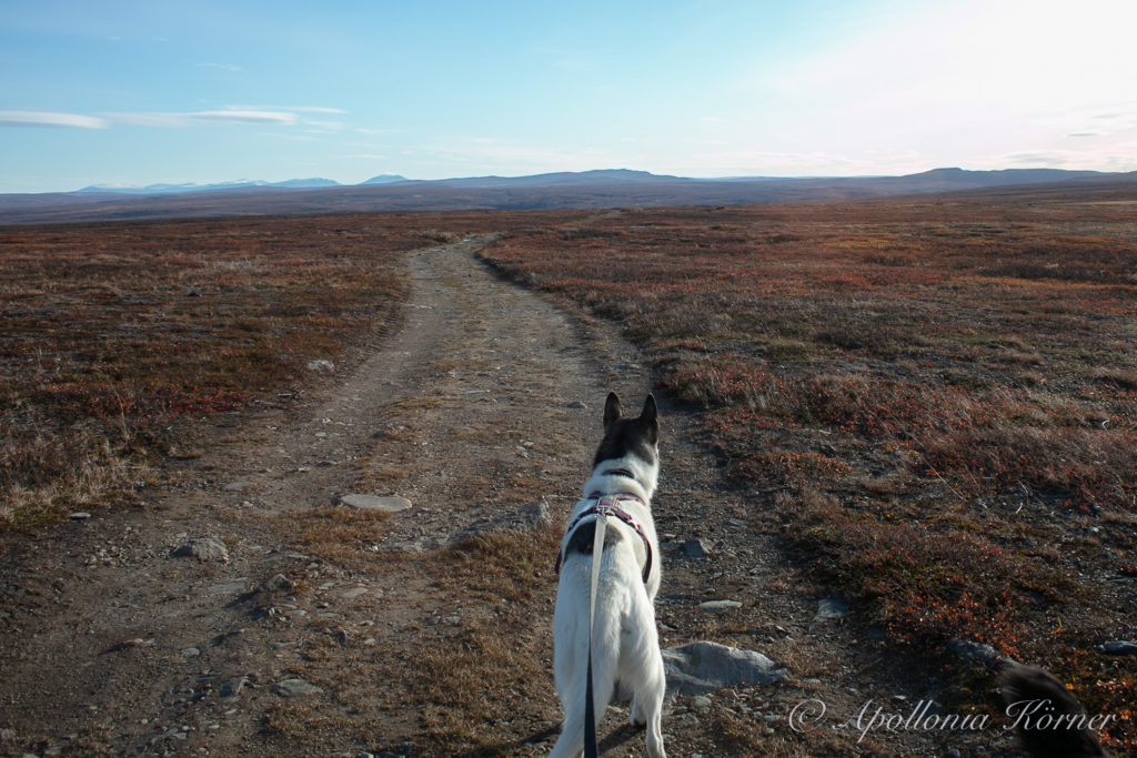
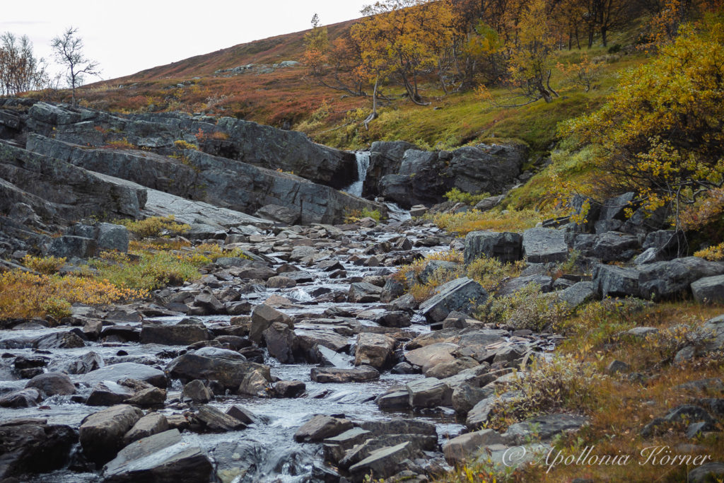
The hiking trail is pretty wide and runs through a rather flat landscape. Some parts are a bit swampy, but wooden planks on the ground prevent you from getting wet feed. After two thirds of the way to the canyon, you have to cross two small rivers. There are no bridges over the rivers. But now it is autumn and the water level is so low so that it is quite easy to come to the other side of the rivers.
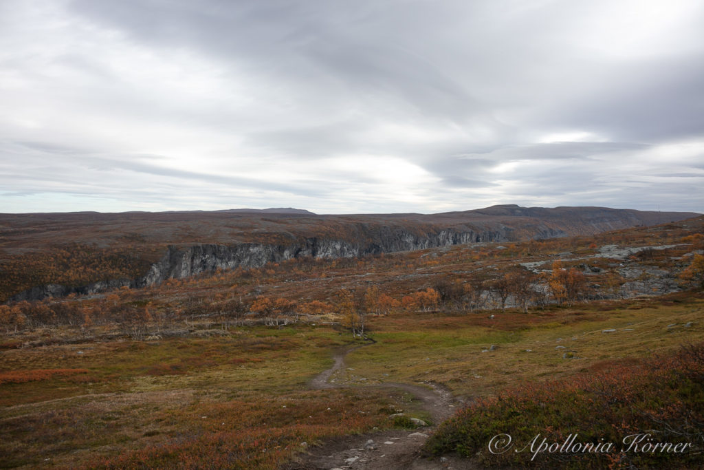
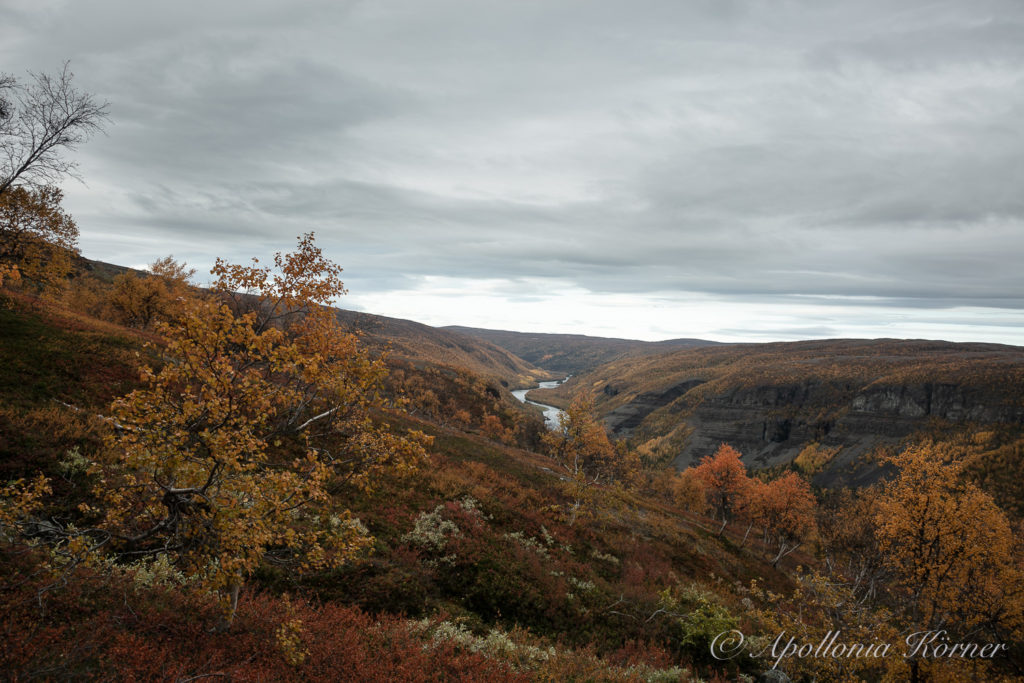
After crossing the second river, I can finally see some kind of formation in the landscape that tells me that there might be a deep canyon. So far, I was walking through a landscape that was just flat until the horizon.
The Alta-Canyon is more than 400 meters deep and, therefore, it is the biggest canyon in northern Europe. Its length varies from 7.5 to 12 kilometers depending on which internet site you want to believe. But the canyon was definitely formed at the end of the last ice age, at least everybody agrees on that.
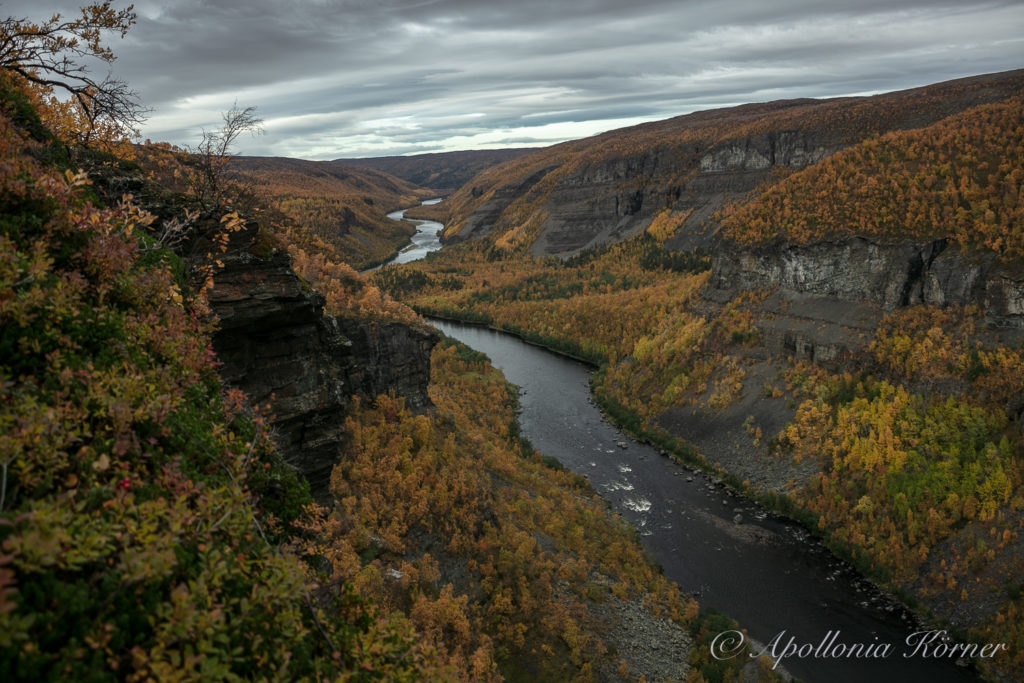
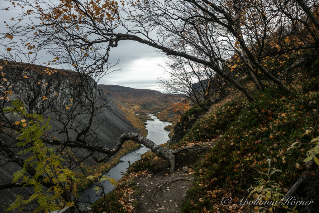
Although the Alta-Canyon is the biggest canyon in northern Europe, I still can’t see it at the end of the hiking trail. The only thing that I can see at the end of the trail is a thick birch forest. I am disappointed. But since I am pretty sure that I’ve seen a big cut in the landscape and that this wasn’t some kind of fata morgana, I start searching the landscape in order to find out how to get to the canyon. Finally, I find a pretty narrow path that is leading to the forest. I follow this path and after I entered the forest, it is getting suddenly quite steep downhill. After approximately two hundred meters I come to a wooden fence. The trees are standing so dense next to each other that it is only possible to get a view into the canyon when I am standing right at the fence. But what a stunning view I have into the canyon! The Alta river is flowing deep down below me while autumn has painted the landscape with fiery colors. I can’t get enough of this natural spectacle and I think this scene is a good end for my short holiday trip through some parts of the Finnmark.
How to get to the Alta-Canyon?
From Alta you take the road E45 to Kautokeino. After approximately eight kilometers you come to a small village called Skillemo. Shortly after Skillemo a small road to the left goes to Gargia Fjellstue. It is approximately nineteen kilometers to Gargia Fjellstue on a tarmac road. After Gargia Fjellstue it becomes a gravel road but it is no problem to drive on this road with a normal car. After 1.5 kilometers you come to a parking place where the hiking trip to the Alta-Canyon starts.