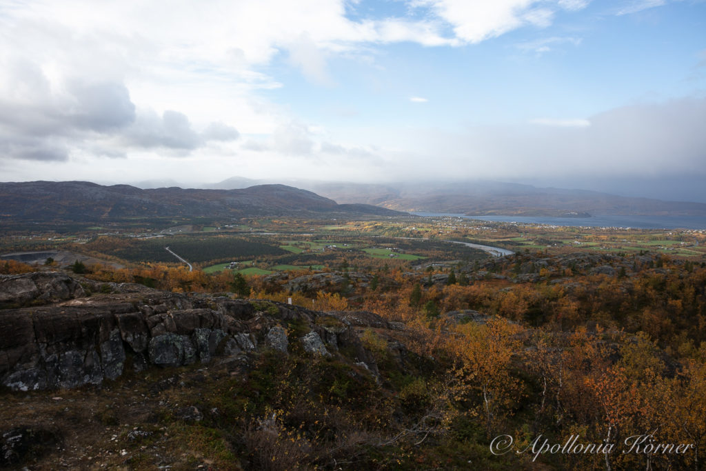
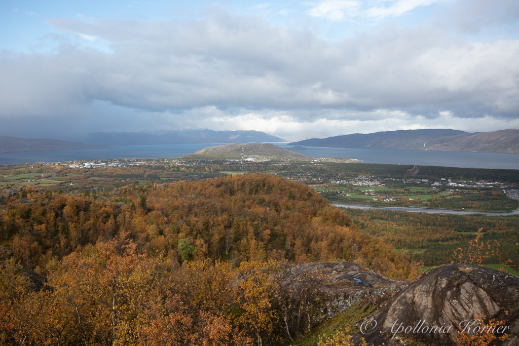
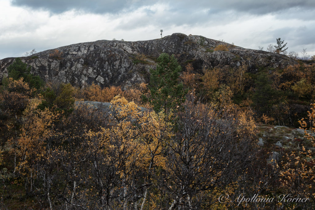
The mountain Lille-Raipas is situated five kilometers south of the city Alta in northern Norway. And not only the view over Alta and the Altafjord is worth it walking to the top of the mountain, but also the historic sites along the way to the top.
You have to take the E45 from Alta to Kautokeino in order to get to the starting point. After approximately four kilometers, you will see the Sami Siida on the right hand site. There is also a sign indicating the way to “Struves Meridianbue”. I follow this sign and turn to the left where I drive over a bridge over the Alta river. After some kilometers I have to turn to the right and follow a gravel road until I come to a parking place.
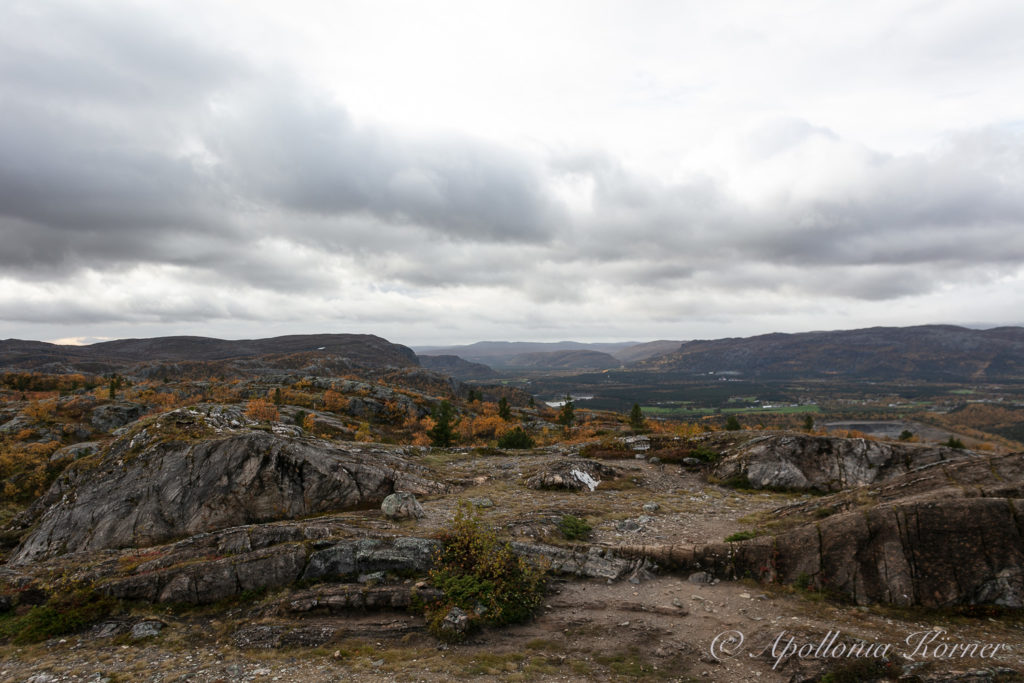
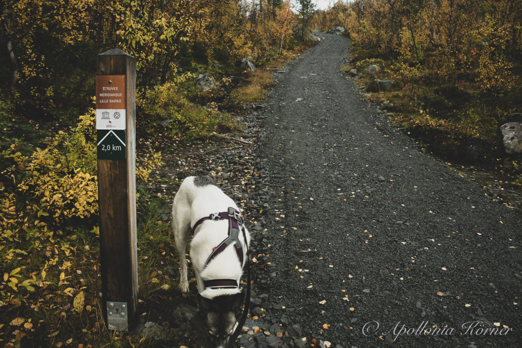
In the beginning, you follow a broad gravel walk that will become smaller after a while. It is 2,8 kilometers to the top of the mountain but you have to walk almost one kilometer before you’ll find the first signpost. It is constantly going uphill and – as always – I am happy that I get some support from my Alaskan Husky Taiga. She is always pulling me uphill quite eagerly. The birch forest along this part of the way is displaying its most beautiful autumn colors.
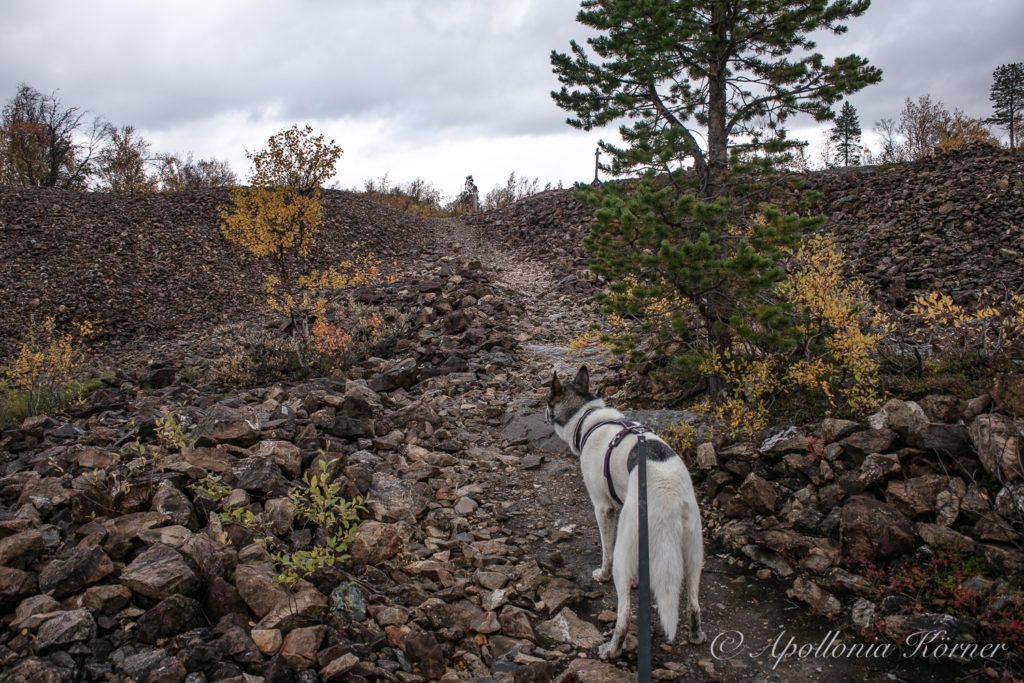
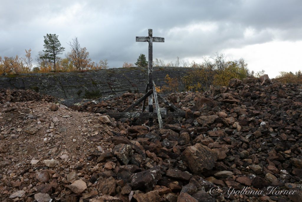
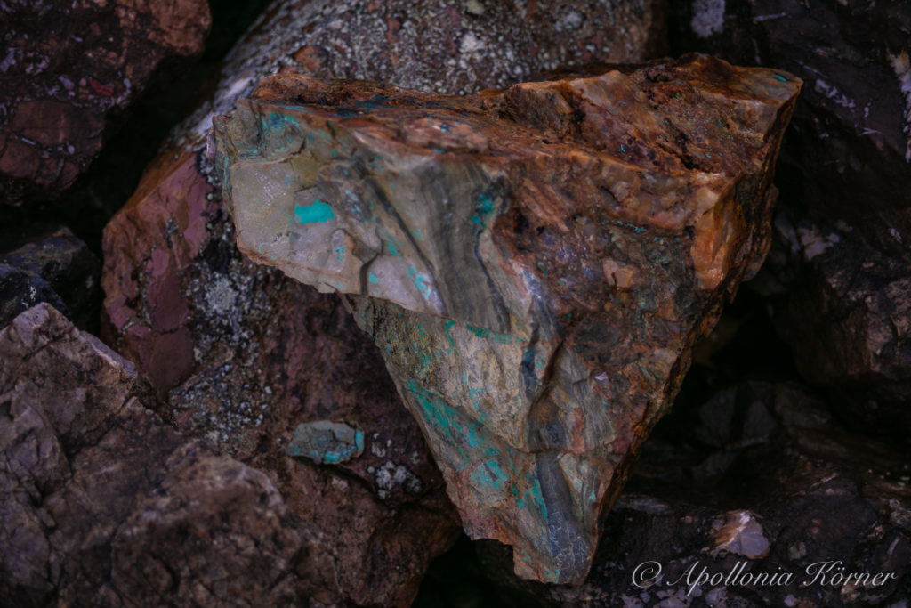
Halfway to the top we come to the old Raipas mine. This is an open place covered with stones and a sign at a wooden cross warns about the deep holes in the ground. This is an old copper mine that was operating from 1836 to 1869 although the copper was already discovered in 1685. Even nowadays, there are enough stones left where you clearly can see the green copper.
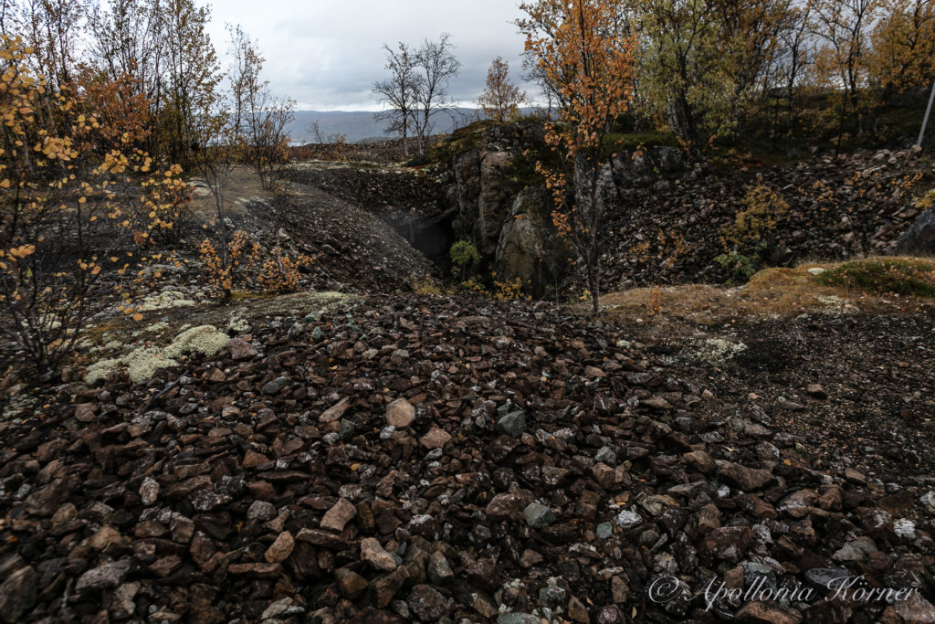
Shortly after leaving the old copper mine behind us, we can see the top of Lille-Raipas for the first time. Although it looks on the photo like as if the mountain is still far away, it doesn’t take more than half an hour until we reach the top.
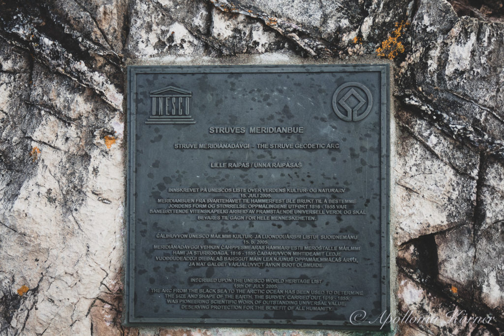
The top of Lille-Raipas was one of the geodetic station points of the German-Baltic astronomer Wilhelm von Struve (1793-1864). Struve wanted to mappings the exact size, shape and flattening of the earth in north and east Europe. Therefore, he erected 265 station points on a distance of almost three thousand kilometers. The Struve Geodetic Arc runs from its northernmost point in Fuglenes near the city of Hammerfest in Norway through the countries of Sweden, Finland, Estonia, Latvia, Lithuania, Belarus, Moldovia until its southernmost point in Stara Nekrassiwka in Ukrania. From my point of view, this is a remarkable achievement and, therefore, it is no wonder that it took almost forty years to complete the work. Since 2005, thirty-four station points are listed on the UNESCO World Heritage List.
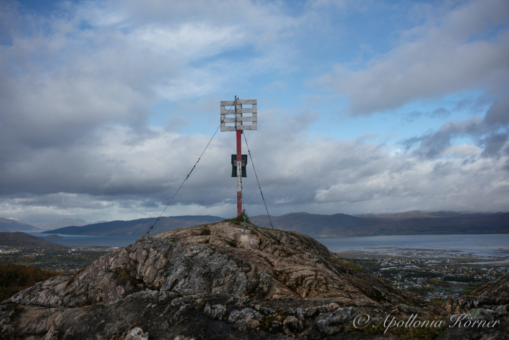
It’s quite windy at the top but the view over Alta, the Altafjord and the surroundings more than compensate for the fresh breeze.